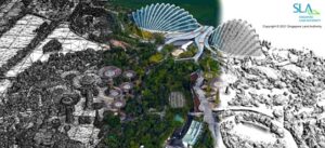
Recently, Singapore completed work on the world’s first digital twin of an entire nation. Bentley Systems tools accelerated the process of transforming raw GIS, lidar, and imagery data into reality mesh, building, and transportation models of the country.

“We envisaged that these building blocks will be part and parcel towards the building of the metaverse starting with 3D mapping and digital twins,” Hui Ying Teo, senior principal surveyor at the Singapore Land Authority (SLA), told VentureBeat.
He says he thinks of digital twins as a replication of the real world through intense digitalization and digitization. They are critical for sustainable, resilient, and smart development. His team has been developing a framework that enables a single source of truth across multiple digital twins that reflect different aspects of the world and use cases.
Singapore is an island nation, and rising sea levels are a big concern. An integrated digital twin infrastructure is already helping Singapore respond to various challenges such as the impact of climate change. A single, accurate, reliable, and consistent terrain model supports national water agency resource management, planning, and coastal protection efforts.
The digital twin efforts are also helping in the rollout of renewable energy. An integrated source of building model data helped craft a solar PV roadmap to meet the government’s commitment to deploy two gigawatts peak (GWp) solar energy by 2030.
From mapping to twinning
One big difference between a digital twin and a map is that a digital twin can be constantly updated in response to new data. A sophisticated data management platform is required to help update data collected by different processes to represent the city’s separate yet linked digital twins. “To achieve the full potential, a digital twin should represent not only the physical space but also the legal space (cadaster maps of property rights) and design space (planning models like BIM),” Teo said.
City and national governments are exploring various strategies for transforming individual geographic, infrastructure, and ownership record data silos into unified digital twins. This is no easy task since there are significant differences between how data is captured, the file formats used, and underlying data quality and accuracy. Furthermore, governments need to create these maps in a way that respects the privacy of citizens, confidentiality of enterprise data IP, and security of the underlying data.
For example, data sources such as cadastral surveys reflect the boundaries of ownership rights across real estate, mineral, and land usage domains. Malicious or accidental changes to these records could compromise privacy, competitive advantage, or ownership rights.
Singapore is the world’s second-most densely populated nation, leading to significant development of vertical buildings and infrastructure. Traditional mapping approaches focused on 2D geography. After a major flood devastated the country in 2011, the government launched an ambitious 3D mapping program to map the entire country using rapid capture technologies, leading to the first 3D map in 2014. This map helped various government agencies improve policy formation, planning, operations, and risk management.
However, the map grew outdated. So, in 2019, the SLA launched a second effort to detect changes over time and update the original map with improved accuracy to reflect the country’s dynamic urban development. The project combined aerial mapping of the entire country and mobile street mapping of all public roads in Singapore.
Capture once, use by many
In the past, each government agency would conduct its own topographical survey to improve planning decisions. “Duplicate efforts were not uncommon because of different development timelines,” Teo said.
The partnership with Bentley helped the SLA to implement a strategy to “capture once, use by many.” This strategy maximized accessibility to the map by making it available as an open-source 3D national map for projects among government agencies, authorities, and consultants. Eventually, they hope to enhance the 3D map to support 4D for characterizing changes over time.
They combine lidar and automated image capture techniques to map the nation rapidly. The new rapid capture process helped reduce costs from SGD 35 to 6 million and time from two years to only eight months.
The SLA captured over 160,000 high-res aerial images over forty-one days. Bentley’s ContextCapture tools worked to transform these into a 0.1-meter accurate nationwide 3D reality mesh. They also used Bentley’s Orbit 3DM tool to transform more than twenty-five terabytes of local street data into the digital twin.
The team standardized on a couple of file formats for different aspects of the data. LAS and LAZ are used for point cloud data. GeoTIFF is used for aligning imagery with physical spaces. CityGML adds support for vector models and surfaces.
Balancing openness and security
Teo said it is vital to strike the appropriate balance between open data and security. Open data enables users to adopt appropriate tools to meet their organization’s needs, regardless of the applications. However, this openness needed to be balanced against security and privacy considerations. They had to ensure that the raw data could be securely processed and made available to agencies, enterprises, and citizens with appropriate privacy safeguards.
All team members underwent security screening, and data was processed in a secure, controlled environment. In addition, various sensitization and anonymization techniques were applied to protect confidentiality. This allowed them to share the data more widely across agencies involved in planning, risk management, operation, and policy without affecting anyone’s data rights.
Data processing was completed in a controlled environment — which means it was isolated from the outside world without network access. This hampered some processes, such as getting technical support when they ran into a problem. “However, a balance has to be struck between time and security for such a nation scale of mapping,” said Teo.
Author: George Lawton
VentureBeat


